The tilt photography technology of UAV consists of data acquisition system and data processing system.
The effective combination of tilt photography and RTK (real-time dynamic carrier phase difference technology) positioning, through multi view image joint adjustment, multi view image key matching and other data processing on the original terrain information, can realize the rapid and accurate calculation of site leveling, subgrade excavation and filling earthwork.
3.
technical basis.
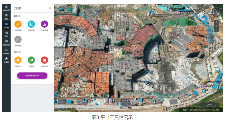
The quality and safety management issues of the intelligent air patrol inspection project, auxiliary operation specifications, accident responsibility determination and backtracking, measure the height, angle, slope and other parameters of the building entity image, realize the integrated monitoring of problem viewing, analysis and comparison, and help the normalization of the project site and all-round control.
4.
2.
At the same time, the three-dimensional real scene model of the construction site in different time periods generated by image data processing is combined with the measurement, analysis and annotation functions to improve the efficiency of multi-party communication progress in project management.
2、 Case application scenarios and technical product features (I) key points of technical scheme as a newly developed technology in the field of international surveying and mapping remote sensing, the essence of UAV tilt photography technology is to carry multiple sensors on the same flight platform and shoot ground objects from multiple angles such as vertical and tilt angles, so as to obtain more complete and comprehensive ground object information.
The workflow of building a three-dimensional real scene model using UAV tilt photography technology is shown in Figure 3, which mainly includes pre flight preparation, tilt image data acquisition and tilt image data processing.
(3) The application scenario UAV tilt photography technology, combined with the unattended hangar, can carry out earthwork survey, image progress check and air patrol inspection, which is applicable to all stages of the whole life cycle of the building.
UAV on duty airport.
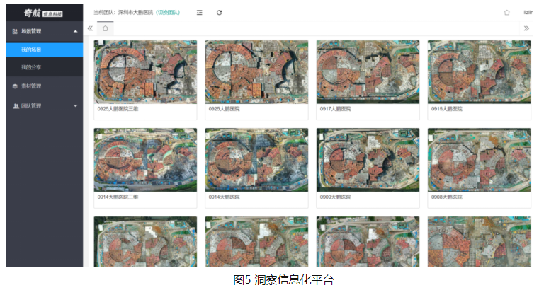
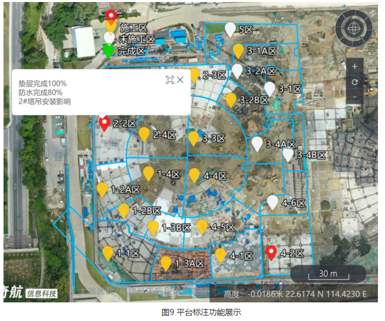
The UAV tilt photography panoramic photos are used to solve the engineering management problems such as coarse granularity and imperfect progress quantitative comparison in the traditional progress management, and cooperate with the insight cloud platform to visually display the real progress of the construction site, so as to carry out visual progress management efficiently and conveniently.
project progress comparison and display.
workflow.
Unlike the Orthophoto Image, which can only observe the target vertically downward, the three-dimensional model established by tilt photography technology has the full size characteristics of the real object, and can measure and analyze the target from any angle.
Based on the on-line engineering data and the real scene model, the project has realized the rapid calculation and analysis of earthwork, the dynamic view and comparison of engineering progress, and can master the project site information without dead ends, so as to improve the fine management level of project progress, improve the efficiency of multi-party communication, and reduce the construction cost of the project.
1、 Basic information Shenzhen Dapeng New Area People’s hospital project adopts the one-stop aerial survey solution of UAV of Shenzhen Dajiang Innovation Technology Co., Ltd.
Data processing system mainly refers to the data processing software used for UAV 3D modeling, including Dajiang Zhitu, contextcapture, metashape, pix4dmapper, etc.
Compared with the traditional manual earthwork survey, it can improve the efficiency of earthwork survey, reduce the error caused by manual survey, and make the data objective, It can be used as an auxiliary verification means of earthwork survey.
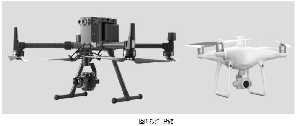
The data acquisition system refers to the main software and hardware facilities for obtaining field data required for the production of three-dimensional real scene models, as shown in Figure 1, mainly including UAV, GPS (Global Positioning System), UAV control system and route planning software.
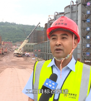
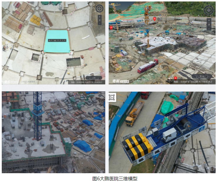
3、 Case implementation (I) basic information of the case: Shenzhen Dapeng New Area People’s hospital is located in Kuixin community, kuizong street, Dapeng new area, Shenzhen, Guangdong Province, with a total building area of 417000 m2, a building height of 80.25m, 16 floors above the ground and 2 floors underground..
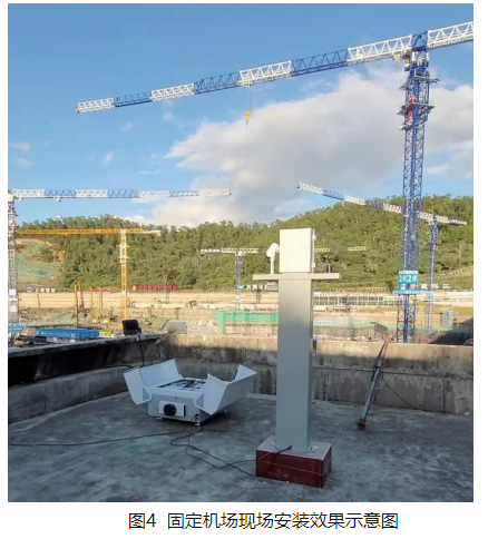
When not working, the UAV stands by in the automatic airport; During operation, the cabin door of the airport is opened, the lifting platform rises to the top, and the UAV takes off automatically and flies automatically according to the established inspection route.

the sensor forms a certain angle with the horizontal line of the ground) is called a oblique film.
3.
It can be used for patrol inspection of safe and civilized construction, patrol inspection management of the state and behavior during the construction process, such as monitoring and management of key positions such as bare soil cover, hoarding, tower crane, etc., making up for the camera monitoring blind area, and timely pushing early warning information for key construction hidden danger areas.
After the image data is transferred into the computer system, it can be processed by special software to establish a three-dimensional model.
online earthwork auxiliary calculation.
to realize the automatic collection and viewing of the whole process of construction site data.
early warning and prediction of safe and civilized construction.
Among them, the image obtained by photographing the ground object at an angle perpendicular to the horizontal plane of the ground surface is a positive film, and the image obtained by photographing the ground object at an inclined angle (i.e.
2.
(2) Technological innovation points 1 The macro and micro comprehensive presentation of the project model.
As the UAV on duty airport has the functions of remote flight task execution, automatic acquisition, automatic charging management, etc., it can perform multiple tasks every day, assist the safe and civilized construction inspection of the project site, and update the project progress in real time.

The project deploys UAV on duty airport in the construction site area, automatically controls the UAV to perform route tasks and collect data at the construction site, automatically starts the model reconstruction task after uploading to the achievement information management platform of Shenzhen Municipal Public Works Bureau, and constructs high-precision two-dimensional orthophoto and three-dimensional real scene models.
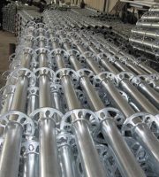
UAV on duty airport, also known as UAV automatic airport, as shown in Figure 2, has the functions of UAV automatic storage, release, recovery and charging, and can directly deploy UAVs to the operation site to solve the problem of carrying UAVs for commuting.
1.
Integrate the high-precision full view real scene 3D model generated by UAV with BIM model, CAD drawing, GIS model and other data to build a “terrain + image + model + vector” macro and micro integrated 3D space scene, so as to realize the full view display of project overview, interactive experience of image progress and scene view of project data.