For road lofting, we first use the road editing software on the desktop of China Haida to design the route
. 
After editing, we import the route into China Haida 30 Handbook
. 
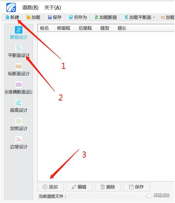
Surveymate is a new PC desktop road editing software launched by China Haida
. 
It supports seven functional modules of road chain breaking, plane section design, vertical section design, standard cross section design, superelevation design, widening design and slope design, and is compatible with multiple formats of import operation; With the help of the powerful interactive function of desktop computer, the indoor road design data can be quickly imported, edited and saved, and the field work can quickly load the hi survey Handbook software for construction lofting, which makes the road construction lofting data editing and field work lofting collection more convenient and efficient
. 
Examples are as follows: the specific steps and precautions are as follows: 1
. 
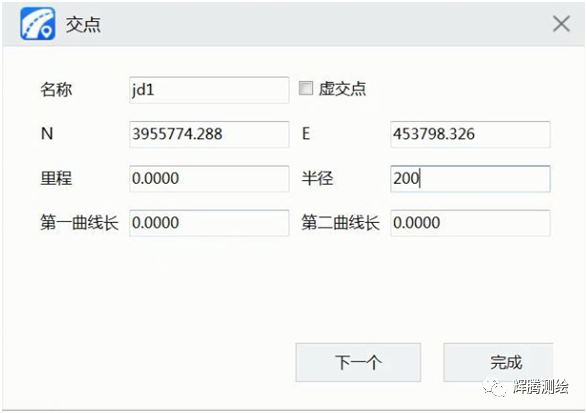
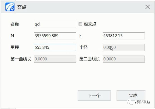
Open the software for curve editing → new project → plane section design → add intersection points
. 
Note: the starting point only needs to input coordinates and mileage (that is, station number)
. 
Note: the later intersection points can be input in turn according to the table, and the later intersection mileage can not be input
. 
After all the input is completed, the software will automatically calculate it as a check
.
Note: the first curve length and the second curve length enter the length of the transition curve, not the length of the curve
.
If there is no transition curve, it can be left blank
.
If there is a numerical value in the table, it means that the first transition curve is equal to the second transition curve
.
If there are two numerical values, the first and the second are entered in turn
.
2
.
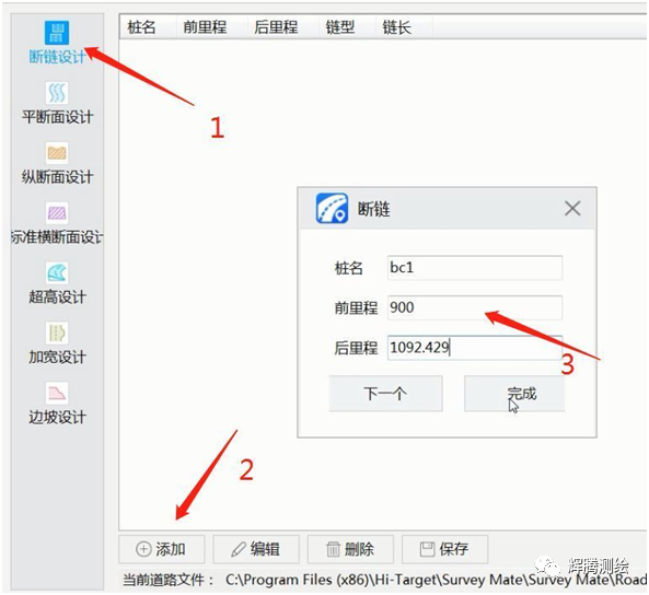
Pay attention to whether the notes are broken
.
Break chain design → add → input mileage before and after 3
.
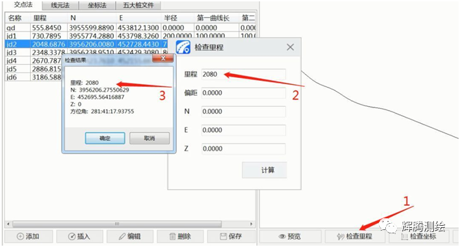
Check is an important step after data editing
.
Preview → first point → check station number → check mileage preview linetype method 1: check mileage and intersection station number calculated by software method 2: according to pile by pile coordinate table, input mileage and check coordinate 4
.
After data saving and checking, save intersection file and broken chain file and copy them to the handbook It can be loaded and used for road lofting..
.